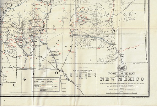
1901 Post Route Map of the Territory of New Mexico

(New Mexico) POST ROUTE MAP OF THE TERRITORY OF NEW MEXICO SHOWING POST OFFICES WITH THE INTERMEDIATE DISTANCES AND MAIL ROUTES IN OPERATION ON THE 1ST OF JUNE, 1901. ALSO RAILWAYS UNDER CONSTRUCTION JUNE 30TH, 1901, AND THE SEVERAL MINING DISTRICTS OF TERRITORY. The Norris Peters Co. . 1901. 57.8 x 46.35 cm.
A very interesting map of New Mexico Territory in 1901, painstakingly showing all the postal routes in the territory, as well as much more. This is one of a series of post route maps of the New Mexico Territory, the first such map apparently issued in 1880. The present map was published under the auspices of the Post Office Department of the United States. Variously colored markings show postal routes throughout the territory, indicating mail service occurring once a week, twice, three times, and six times a week. The beginnings and ends of routes are shown, as are mail messenger, rural free delivery, and special supply routes. The locations of post offices (and distances between) and county seats are indicated, as are the locations of 116 separate mining districts. The locations of several railroads and electric and cable car lines are also shown, as well as rivers and streams, all on a map that provides a remarkable amount of information. OCLC locates only 3 copies of this 1901 map, at the Museum of New Mexico Library, at the University of Texas at Arlington, and Michigan State Univ. Rare. Very fine condition.
