Northern Idaho and Southeastern Washington Pipeline Photographs - c. 1960

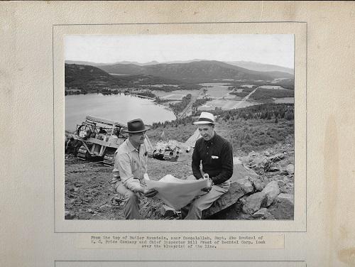
[Pipeline Photographs - Northern Idaho and Southeastern Washington) H.C. Price Co., The Pacific Gas Transmission Company. [ca. 1960] 18 card panels, each approximately 16" x 20" holding a total of 35 8" x 10" black and white silver print photographs. Each discretely numbered in ink on verso (1-18). Card no. 1 with a single photograph and 12 line typed caption sheet mounted below, the balance each with two mounted photographs and typically 2-line typed caption strips mounted below. Card versos blank. Some mild handling wear, soil (most pronounced to card no. 1), otherwise each well preserved. Photos near fine, group about very good-plus, on the whole. An impressive archive of original photography documenting the circa-1960 construction of a section of a 36", 1300+ mile natural gas pipeline through Northern Idaho into Southeastern Washington. Captions here identify the pipeline as being the project of the Pacific Gas Transmission Co., overseen by pioneering pipeline contractors H.C. Price Co. According to a 2001 press release, the pipeline, now part of the Pacific Gas and Electric Gas Transmission Northwest (or GTN) first went into service in December of 1961 and extends some 290 miles into Canada to the north, and into southern Oregon to the south, eventually interconnecting into the PG&E pipeline system in Northern California. The route has since been expanded into a series of three pipelines (with this original 36" pipe designated as the "A" line). Photographs capture in expert clarity and resolution, the difficult terrain and conditions encountered in the line's construction with detailed views of multiple river and highway crossings. Identified locations include Bonners Ferry (ID), Sandpoint (ID), a Moyie River crossing near Eastport (ID), Spokane (WA), and Plaze (WA). A vivid primary visual record of pipeline construction in Idaho and Washington State at mid-Century.


